
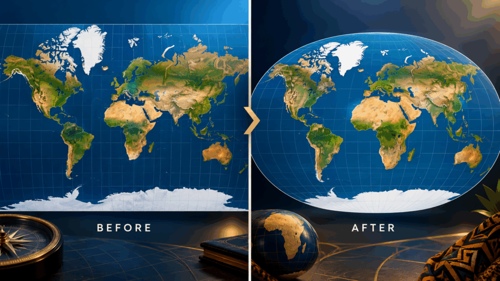
A new chapter in global cartography is beginning, with Africa at the centre of an international effort to make world maps more accurate and representative.
On September 4, the United Nations General Assembly overwhelmingly approved a resolution encouraging governments, schools, international organisations and technology companies to consider map projections that better represent the relative size of the world’s continents. The initiative was led by Togo on behalf of the African Group and supported by the African Union, receiving 164 votes in favour, one against and six abstentions.
At the heart of the initiative is a simple geographic reality: different map projections can make continents appear very different in size. The widely recognised Mercator projection was originally developed for navigation and is particularly useful for showing direction. However, it does not preserve the actual area of landmasses, meaning regions farther from the Equator can appear much larger than they are.
Unstoppable Africa 2026 to Drive Investment and Growth in New York
For Africa, the difference is especially noticeable. Africa covers about 30 million square kilometres, making it one of the world’s largest continents. On traditional Mercator maps, however, its size can appear considerably smaller in comparison with territories at higher latitudes. Under an equal-area projection such as Equal Earth, the relative size of Africa is represented much more accurately.
The comparison with Greenland offers one of the clearest illustrations. Although the two landmasses can appear relatively similar in size on a Mercator map, Africa is actually about 14 times larger than Greenland. Equal-area projections provide a visual representation that reflects that geographic reality more closely.
For African countries, the initiative represents an opportunity to strengthen geographic education and encourage a more accurate understanding of the continent. The campaign also highlights the important role African governments can play in shaping international conversations about education, technology and global representation.
Togo’s leadership has been particularly significant. Working with the African Union and other partners, the West African country brought the issue to the United Nations and helped transform a discussion about maps into a global conversation about accurate geographic representation. The UN’s Office of the Special Adviser on Africa has described the outcome as a victory for Africa.
The resolution also creates an opportunity for schools and educational institutions to introduce students to different types of maps and explain why the shape and size of continents can change depending on the projection being used. Togo has indicated plans to update its geography materials, while the wider initiative encourages international organisations and technology companies to consider more accurate representations.
Importantly, the resolution does not mean that one map will replace every other map. The United Nations has not banned the Mercator projection, which continues to have practical applications in navigation. Instead, the initiative encourages the use of projections that are better suited to showing the actual relative size of continents, particularly in educational and public-information settings.

The significance of the development extends beyond cartography. It demonstrates how an initiative emerging from Africa can gain broad international support and contribute to a more informed understanding of the continent. With 164 countries backing the resolution, the discussion has become part of a wider global effort to improve how geographic information is communicated.
For Africa, the moment offers a positive message about leadership, knowledge and representation. The continent is not becoming larger, and the world’s geography has not changed. What is changing is the way that geography can be presented to students, audiences and communities around the world.
The new approach offers an opportunity to see Africa in its proper geographic context — vast, diverse and central to the story of our planet.
The map is changing, but the bigger story is one of greater accuracy, better education and Africa taking an active role in shaping how the world understands its geography.