The African Union (AU) has adopted a historic initiative aimed at correcting the way Africa is represented on maps around the world, marking a significant milestone in the continent’s efforts to reshape global perceptions and ensure that Africa is portrayed according to its true geographical scale.
Approved by African leaders during the African Union Assembly, the initiative goes beyond cartography, reflecting a broader political, educational, and cultural commitment to strengthening Africa’s position on the global stage while challenging longstanding misconceptions that have persisted for generations.
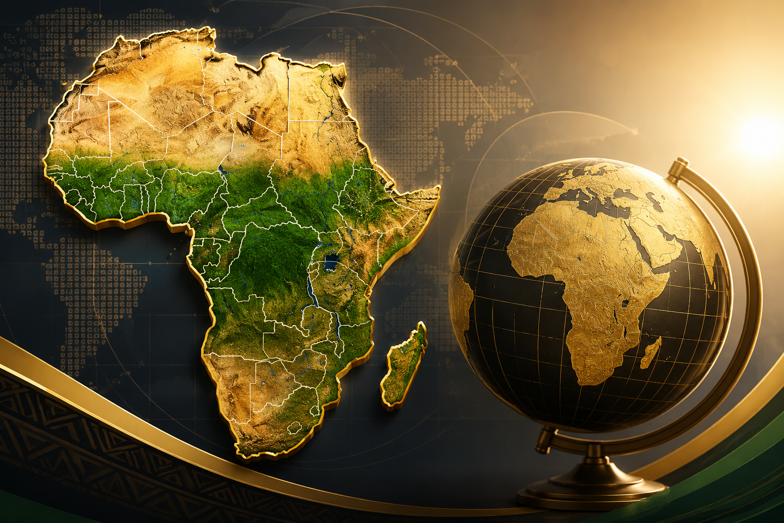
For decades, many of the world’s most widely used maps have relied on projections that significantly distort the relative size of countries and continents. One of the most commonly used, the Mercator projection, has often depicted Africa as considerably smaller than its actual landmass, despite the continent covering approximately 30.37 million square kilometres making it the second-largest continent on Earth and large enough to contain countries such as the United States, China, India, and much of Europe simultaneously.
AVANTE Talks Breakfast Highlights Entrepreneurship Challenges in Equatorial Guinea
According to the African Union, correcting these distortions is not simply an academic exercise. The initiative seeks to ensure that Africa is represented in a manner that accurately reflects its true geographical dimensions, strategic importance, economic potential, and growing influence in global affairs. The organization noted that the campaign aligns with its broader objective of “reclaiming Africa’s rightful place on the global stage,” emphasizing that the way the continent is visually represented has a direct impact on education, public perception, policymaking, and international understanding.
To launch the initiative, the African Union Commission, in collaboration with the Republic of Togo, will convene a continental workshop bringing together Member States, cartographers, geospatial specialists, educators, researchers, policymakers, media professionals, civil society organizations, technology experts, and international partners.
The workshop will be tasked with developing a comprehensive roadmap that will guide the implementation of the initiative across Africa and internationally. The roadmap is expected to establish clear recommendations covering public policy, educational reform, technological standards, digital mapping, communications, and advocacy to encourage the adoption of more accurate representations of Africa worldwide.
In parallel, the African Union Commission has established an interdepartmental task force responsible for coordinating the implementation and promotion of the campaign across its various institutions and departments. The task force will oversee collaboration with governments, educational institutions, mapping agencies, publishers, and international organizations to facilitate widespread adoption of the initiative.
A central pillar of the campaign is the promotion of cartographic projections that more accurately reflect the continent’s true size while encouraging their integration into school curricula, universities, atlases, academic publications, digital platforms, media organizations, and international institutions.
Officials believe that improving the accuracy of Africa’s representation will contribute to a better understanding of the continent’s immense geographic diversity, economic opportunities, natural resources, and demographic significance. Home to more than 1.5 billion people and the world’s youngest population, Africa is increasingly recognized as a key driver of global economic growth, innovation, and sustainable development.
The initiative also complements the African Union’s broader Agenda 2063 vision, which seeks to strengthen African unity, promote inclusive development, enhance regional integration, and ensure that African perspectives are more prominently reflected within global institutions.
Beyond education, the campaign is expected to encourage greater awareness among technology companies, publishers, developers of digital mapping services, and international organizations whose geographic products influence millions of people every day. By advocating for scientifically accurate and inclusive cartographic standards, the AU hopes to help reshape how future generations perceive the African continent.
The expected outcome is the gradual adoption of standardized and accurate cartographic representations across educational systems, government institutions, digital platforms, international organizations, academic research, and media publications, ensuring that Africa is consistently portrayed in proportion to its actual size and global importance.
As Africa continues to strengthen its voice in international affairs, the initiative represents another step toward promoting African-led narratives and reinforcing the continent’s identity through factual representation. More than correcting maps, the campaign seeks to redefine perceptions, celebrate Africa’s true scale, and affirm its growing role in shaping the future of the global economy and international cooperation.
Source: African Union (AU).


